Difference between revisions of "Map of Inland"
From Riddley Walker Annotations
Eli Bishop (talk | contribs) |
Eli Bishop (talk | contribs) |
||
| Line 1: | Line 1: | ||
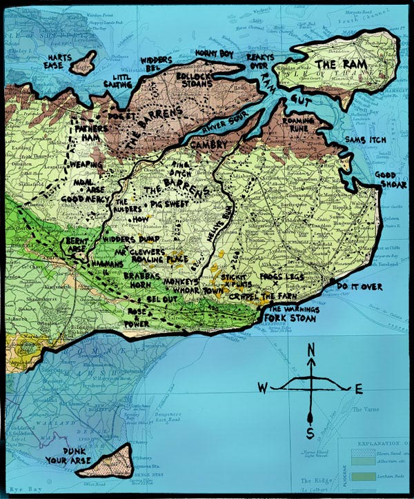
The map from the beginning of the book (illustration by Russell Hoban, used by permission) superimposed on the outlines of present-day southeast England. The area is about forty by forty miles. This and all of the enlarged detail maps in the annotations are by {{By|BJB}}. See [[places]]. | The map from the beginning of the book (illustration by Russell Hoban, used by permission) superimposed on the outlines of present-day southeast England. The area is about forty by forty miles. This and all of the enlarged detail maps in the annotations are by {{By|BJB}}. See [[places]]. | ||
| − | [[File:inland.jpg|frame|center]] | + | [[File:inland.jpg|frame|center|link=]] |
Latest revision as of 00:54, 4 December 2013
The map from the beginning of the book (illustration by Russell Hoban, used by permission) superimposed on the outlines of present-day southeast England. The area is about forty by forty miles. This and all of the enlarged detail maps in the annotations are by BJB. See places.