Map of Inland

From Riddley Walker Annotations
Revision as of 22:03, 28 July 2013 by Eli Bishop (talk | contribs) (Created page with "The map from the beginning of the book (illustration by Russell Hoban, used by permission) superimposed on the outlines of present-day southeast England. The area is about for...")
(diff) ← Older revision | Latest revision (diff) | Newer revision → (diff)
Jump to: navigation, search

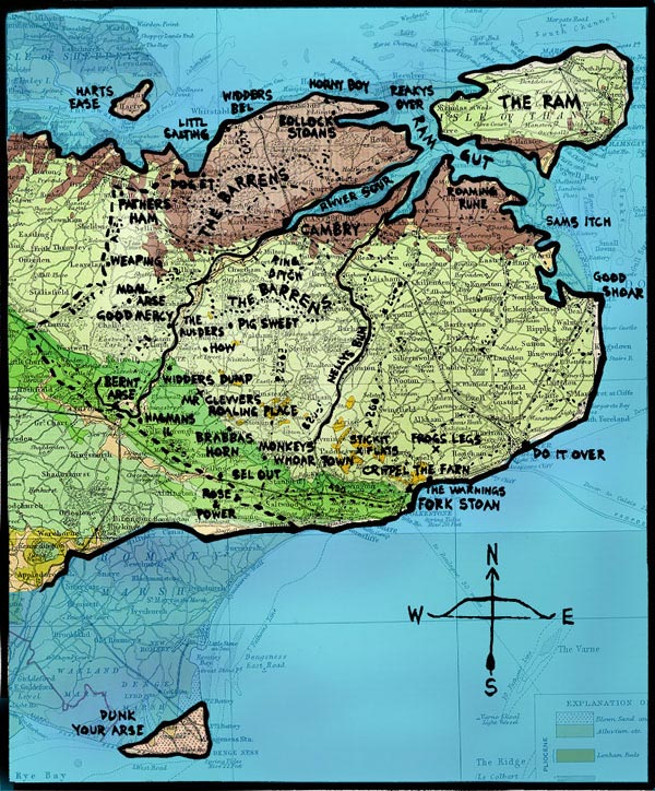
The map from the beginning of the book (illustration by Russell Hoban, used by permission) superimposed on the outlines of present-day southeast England. The area is about forty by forty miles. This and all of the enlarged detail maps in the annotations are by BJB. See places.

Inland.jpg