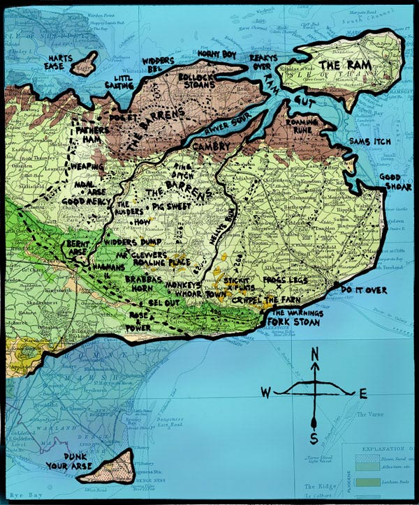
The map from the beginning of the book (illustration by Russell Hoban, used by permission) superimposed on the outlines of present-day southeast England. The area is about forty by forty miles. This and all of the enlarged detail maps in the annotations are by BJB. See places.